
Troubled river on royal manor that just keeps rolling along.
It has flooded and been polluted but now is a ‘green lung’
Otters, Poetry, and landslides: Havering’s River Ingrebourne has much secret history. The Domesday Book of 1086 records that Havering had a water mill. This was powered by the Ingrebourne but wasn’t actually on the river. Our Saxon ancestors dug a channel about a mile long parallel to the Ingrebourne to build up a head of water for a mill pond at Dovers, just north of Rainham. The channel has been mostly scooped out by gravel digging, but the remains can be seen on Google Earth just east of La Salette Catholic church and north of A1306 New Road.
The Ingrebourne was the boundary between the royal manor of Havering, on the west bank, and the parishes of South Weald, Upminster and Rainham to the east. Usually, bridges over a boundary river would be the joint responsibility of the communities on either side. But peasants on the royal manor of Havering were exempt from any contribution. Medieval kings had the right to levy special taxes on their own tenants - so kings needed Havering people to have cash in their pockets!
As late as 1825, Upminster people threatened to go to law to make Hornchurch pay its share - but they got legal advice telling them they had no chance. That’s why the District Line has a station called Upminster Bridge and not Hornchurch Bridge linking the two places was literally Upminster’s problem. Downstream, Hacton Bridge had to be maintained by the owner of Gaynes, a property near Corbets Tey. Hacton Bridge, which existed by 1299, was just a foot bridge, big enough to lead a horse over the Ingrebourne.
Engineering challenge
Around 1660, locals persuaded a carpenter who was mending it to widen it to take carts, so they could get to Romford market. The owner of Gaynes was furious when he got the bill.
The Ingrebourne was a major engineering challenge to the Eastern Counties Railway (the Liverpool Street line), which was extended from Romford to Brentwood in 1839-40. Its zig-zag course south of Church Road, Harold Wood, exactly coincided with the line of the railway, making necessary a huge embankment for over half a mile. In the 1890's, the Ingrebourne caused several landslides, and the railway company eventually realigned the river in an artificial channel away from the embankment.
The Ingrebourne had become a problem because it was carrying a lot more liquid, and the story isn’t pleasant. In 1868, a Brentwood solicitor called William Preston turned property developer and built the first houses at Harold Wood. With grandiose delusions, he bought a farm at Shepherd’s Hill which for 460 years had been called Goodhouse. This he replaced with a huge mansion which he named Harold Court - now flats.
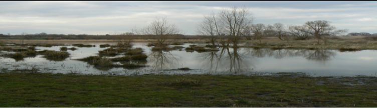
Preston got into financial trouble, and in 1871 he sold land so Brentwood could build a much-needed sewage works, discharging into the humble Ingrebourne. The sewage farm is still there in Nag’s Head Lane - but it was inefficient. The Ingrebourne became severely polluted. In a long case in the 1890's, a Hornchurch farmer sued Brentwood because his cattle refused to drink from the Ingrebourne. Around 1830, an otter was captured on the Ingrebourne. Sadly, it soon died in captivity, and no more were seen. By 1900, Rainham people were expert at catching eels - fish that like polluted streams.
Two Literary attempts were made to serenade the Ingrebourne. In 1880, Upminster local historian Thomas Wilson Wrote of the Ingrebourne “hurrying along and sweetly gurgling” although admitted that most people “think very little of a walk beside our river”. In 1884, a Brentwood doctor called Cornelius Butler published a poem called “Ingrebourne”. It never caught on.
The Ingrebourne was notorious for flooding. There was a famous flood caused by a cloudburst in 1888. The Ingrebourne cut two new channels, five feet deep, on the west side of Upminster Bridge, which had to be rebuilt - this time by the new Essex County Council, which also widened the bottle neck. Its occasional waywardness has been a blessing. Most housing developments have kept away from the Ingrebourne, creating a kind of internal “green belt” through the borough.
By historian Prof Ged Martin
Courtesy of the Romford Recorder